Top
The Falls
33.9029239,-98.508116 | website
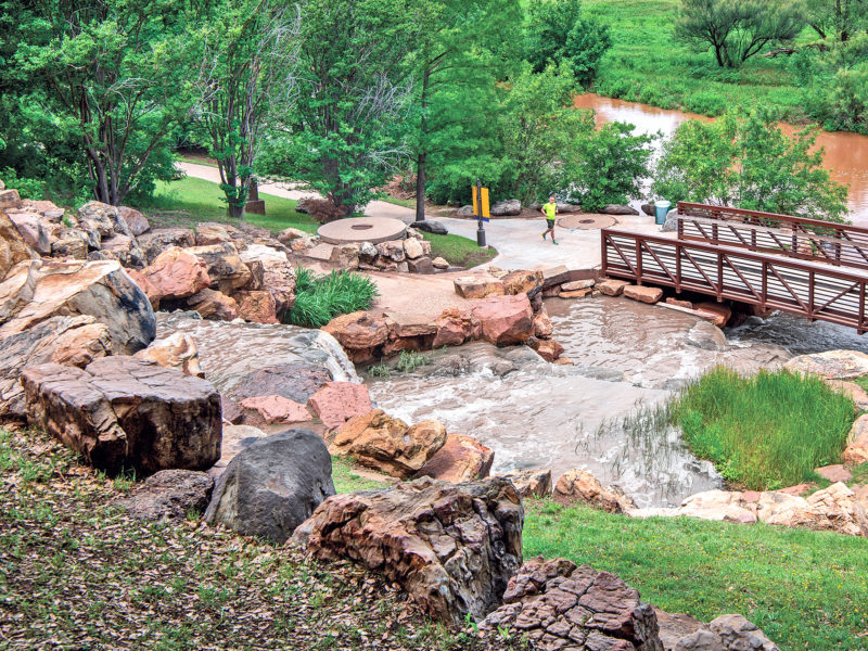
The city’s original falls (the namesake of the city) washed away in a flood in the 1800’s. In 1987 a new falls was constructed upstream. The present 54-foot man-made waterfall is a multi-level cascade on the south bank of the Wichita River. The Falls can be seen by southbound motorists on I-44 as they cross the bridge over the river.
The Falls provides many wonderful photo opportunities, and it is also the site of many outdoor weddings each year. You can access it by bike or walking on the Circle Trail. Parking areas are available just inside Lucy Park on Sunset Drive that has access to the Circle Trail. It is about a 1-mile walk to the Falls and back. You can also park along the service road which circles under the I-44 bridge over the Wichita River. The Falls Trail map shows how to access the parking areas.